
AUSTRALIA, 23 March 2026 – Ex-Tropical Cyclone Narelle, having carved a destructive path across northern Australia, has been downgraded to a tropical low but continues to unleash heavy rain and flooding as it moves west. The system, which made landfall in Queensland as a powerful Category 4 cyclone last week, is now forecast to potentially re-intensify off the Western Australian coast, with Perth in its sights later this week.
From Category 5 Threat to Tropical Low
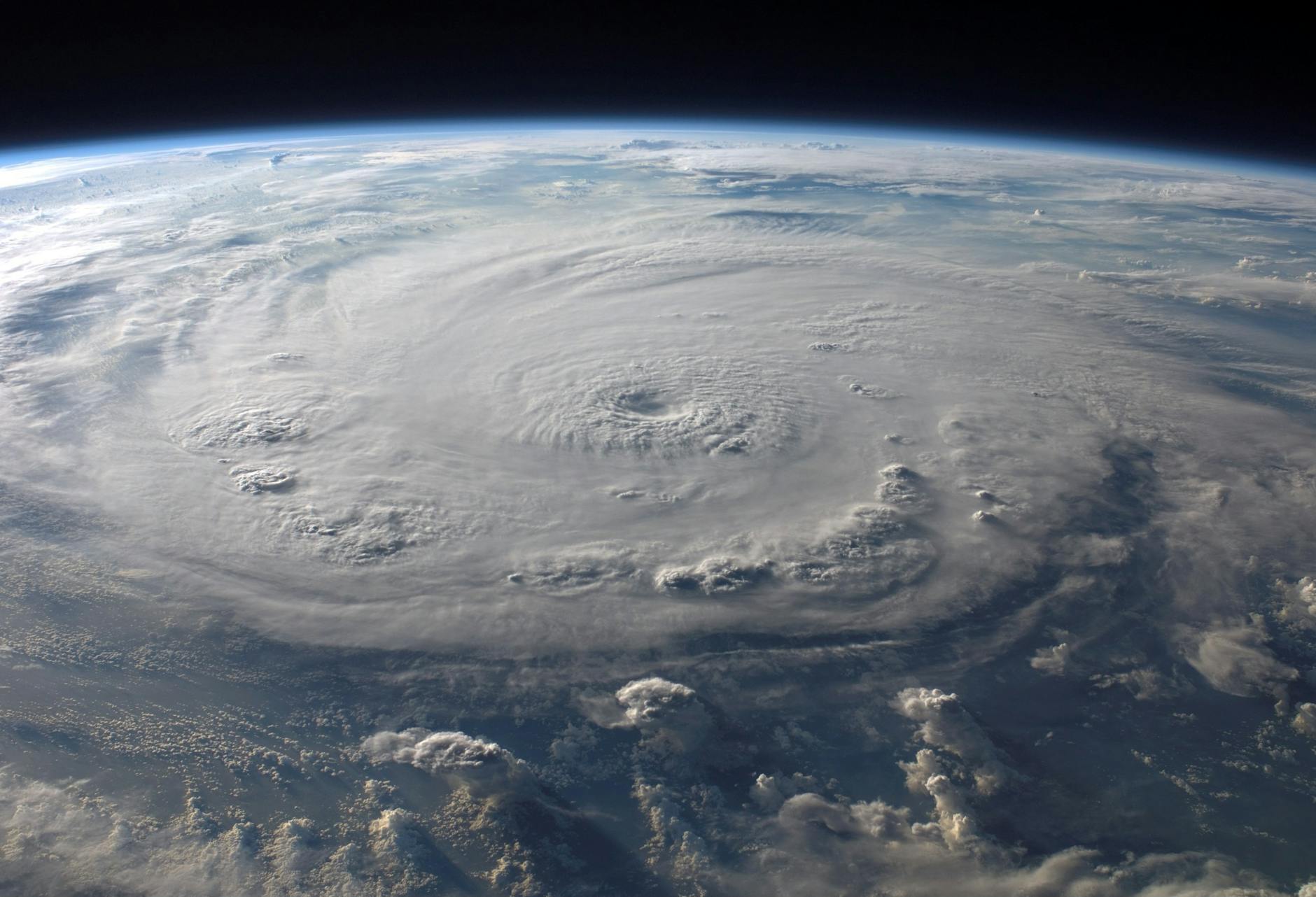
Severe Tropical Cyclone Narelle formed in the Coral Sea around 16 March, rapidly intensifying into a major system. Forecasters warned it could reach Category 5 strength, with sustained winds near the centre peaking at 205 km/h and gusts to 285 km/h. It made its first landfall on the Cape York Peninsula in Far North Queensland on Friday, 20 March, as a Category 4 cyclone, bringing “bloody horrendous” conditions that crushed buildings, downed sheds, and stripped trees bare. Residents sheltered in boats, bunkers, and shipping containers as the storm passed.
After crossing Cape York, Narelle moved into the Gulf of Carpentaria and made a second landfall on the Northern Territory coast on 21 March. It has since been downgraded to a tropical low but remains a potent rain and flood event. Northern Territory Chief Minister Lia Finocchiaro confirmed there has been no major damage to infrastructure and no reports of injuries from the system’s passage across the NT, a relief for communities already dealing with saturated ground.
Current Situation: Flooding Focus Shifts West
As of Monday, 23 March, the severe weather threat has eased across the Top End as Ex-TC Narelle moves away. However, it continues to dump heavy rainfall, triggering major flood warnings for several river systems, including the Adelaide, Daly, and Waterhouse rivers. The town of Katherine is on high alert, with authorities cautiously optimistic it may be spared the worst of the flooding.
The system is now tracking westward towards the Kimberley region of Western Australia. A warning zone has been declared for parts of the WA coast, with the system expected to bring damaging winds and heavy rain as it crosses the border.
Forecast: Potential Re-intensification and Perth Impact
The most significant development is the forecast for Ex-TC Narelle to move back over warm ocean waters off the north-west coast of Western Australia later this week. The Bureau of Meteorology advises the system could re-intensify, potentially reforming into a tropical cyclone.
Current modelling suggests the system will then track southwards, potentially impacting the Perth metropolitan area by the weekend. While the strength of the system upon reaching Perth is uncertain, authorities are warning residents to prepare for a period of severe weather, including heavy rainfall and strong winds.
Frequently Asked Questions
What was Cyclone Narelle’s peak intensity?
Cyclone Narelle reached peak intensity as a Category 4 system just before making landfall in Queensland, with sustained winds of 205 km/h near its centre and gusts up to 285 km/h. It was forecast to potentially reach Category 5 strength over the Coral Sea.
Which areas have been affected so far?
The cyclone has impacted a vast area:
- Queensland: Cape York Peninsula (landfall 20 March). Significant damage reported in communities like Coen and Archer River.
- Northern Territory: Crossed the coast on 21 March, bringing heavy rain and flooding to the Top End. Major flood warnings are current for several rivers.
- Western Australia: The system is currently moving into the Kimberley region, with warnings for damaging winds and heavy rain. There is potential for impacts in Perth later this week.
Has there been any loss of life or major damage?
Northern Territory authorities have reported no major infrastructure damage and no injuries from Narelle’s passage across the NT. Initial reports from Queensland indicated significant localised property and vegetation damage, but no widespread loss of life has been reported.
What should residents in Western Australia do?
Residents in the Kimberley and, later, those in the Perth region should monitor official warnings from the Bureau of Meteorology and their local State Emergency Service (SES). Preparations should include securing loose items, clearing gutters, and having an emergency kit ready. Power and water utility Power Water advises customers to call 1800 245 092 to report outages or damage to infrastructure.