
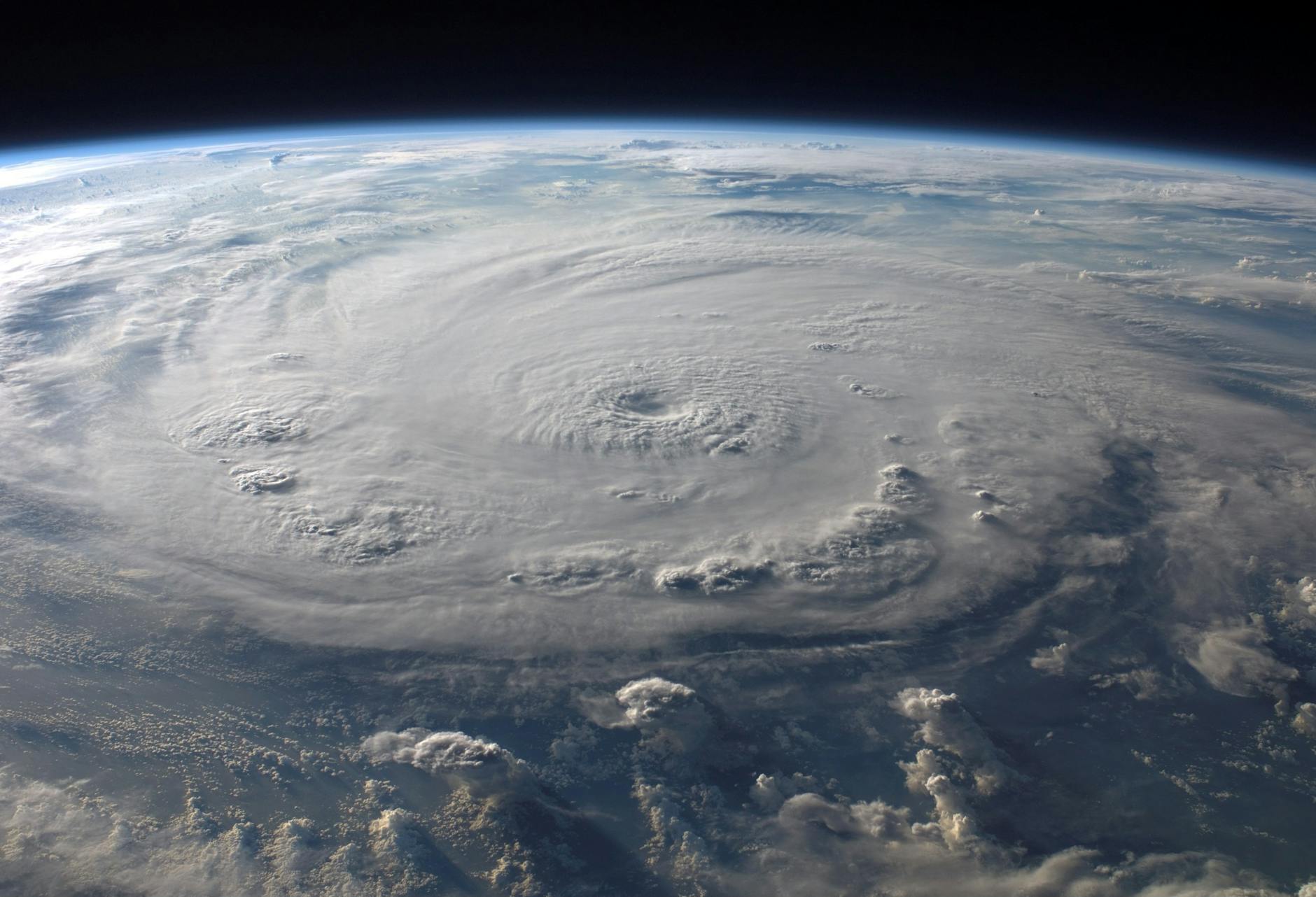
PERTH, 24 February 2026 – Tropical Cyclone Horacio has officially become the strongest storm of the 2026 season, reaching Category 5-equivalent intensity in the South-West Indian Ocean. After a period of rapid intensification that saw the system develop a clear 20-nautical-mile-wide eye, the storm is now beginning to show the first signs of weakening as it moves over open waters.
Current Status and Intensity
As of Tuesday, 24 February 2026, Horacio is located east of Mauritius and Rodrigues Island. The system reached its peak intensity on Monday afternoon, 23 February, with sustained winds estimated at 260 km/h (160 mph) and gusts exceeding 300 km/h. This makes Horacio the first Category 5 tropical cyclone recorded globally in 2026.
Meteorological data from the Mauritius Meteorological Services indicates the storm is currently moving South-Southwest at approximately 19 km/h. While the storm remains a powerful “Intense Tropical Cyclone,” satellite imagery shows the core is beginning to encounter less favourable conditions, leading to a gradual decrease in central pressure and wind speeds.
Technical Specifications
The following data represents the peak and current recorded metrics for Tropical Cyclone Horacio (22S) based on the latest meteorological reports.
| Metric | Details |
|---|---|
| Classification | Intense Tropical Cyclone (Category 5 Equivalent) |
| Peak Sustained Winds | 260 km/h (160 mph) |
| Peak Gusts | Over 300 km/h |
| Minimum Central Pressure | 955 hPa |
| Current Movement | South-Southwest at 19 km/h |
| Sea Surface Temperatures | 27–28°C (at peak intensification) |
Forecast and Land Impact
The primary threat to inhabited land has largely subsided. Earlier this week, Rodrigues Island was placed under alert; however, the threat level has since decreased as Horacio maintains a track away from the island. Forecasters at the Joint Typhoon Warning Center (JTWC) expect the system to continue its southward trajectory over the next 48 hours.
As Horacio moves into cooler waters and encounters higher vertical wind shear, it is projected to transition into a post-tropical system. There are currently no warnings in place for mainland Africa, India, or Australia, as the storm is expected to dissipate over the open ocean.
Frequently Asked Questions
Is Cyclone Horacio a threat to Mauritius or Rodrigues?
The threat to Rodrigues Island has decreased significantly as the storm is now tracking to the southwest, away from the island. While rough seas and some wind may still affect the region, the core of the storm is moving into open water.
Why did Horacio intensify so quickly?
Horacio took advantage of exceptionally favourable conditions, including warm sea surface temperatures of 27–28°C and low wind shear. This allowed the storm to undergo rapid intensification, forming a well-defined eye and reaching Category 5 status within a short window.
Will this cyclone affect the Australian coastline?
No. Tropical Cyclone Horacio is located in the South-West Indian Ocean, thousands of kilometres from the Australian coast. It is forecast to remain in the central Indian Ocean before weakening.
How does Horacio compare to other 2026 storms?
Horacio is currently the strongest storm of 2026 globally. It is the first system this year to reach the Category 5 threshold on the Saffir-Simpson scale.